A special thanks goes out to The Holiday Guide for suppling us with much of the information below. If you are in St Lucia look out for Channel 50 on our local TV, see more of what The Holiday Guide has to offer.
Castries
Latitude 14° 00′ N / Longitude 60° 59′ W
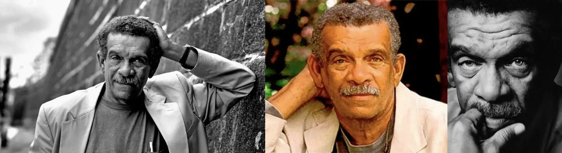
Capital City of Castries named after the Marechal de Castries; a French minister of the Marine. We’re in the Derek Walcott Square, formally called Columbus Square. It was renamed after our second Nobel Prize winner from St Lucia. That’s right; this little island nation boasts two Nobel Laureates. Sir Arthur Lewis for Economics and Derek Walcott for literature in 1993.
The Square is in the heart of the city nestled between the uniquely ornate Roman Catholic Cathedral built in 1897 and the Castries Central Library. Here you may also stroll in amongst some of the oldest French colonial architechture remaining in the capital. Castries suffered two very debilitating fires in recent history almost leveling the town and crippling the island.
Today she is a bustling Centre with a natural harbour welcoming several cruise lines from around the world. Offering excellent shopping in the town market for fresh produce and arts and crafts, Duty Free centres and even a glimps at the process of the fine art of silk screening. The cool shade of this 400 year old Samaan tree is far too tempting.
A little bit of its history: Castries is the capital, commercial center and main cruise port of St Lucia.
The town was founded by the French in about 1768 under the name Car’nage and renamed after a French official in 1785. The earlier settlement across the harbor at Vigie, started in 1651, was abandoned after the devastating hurricane of 1780.
From 1803 to 1844 the British made the town a major naval port and built fortifications on Morne Fortune, the mountain which overlooks this important harbor. By 1844, Castries had a population of 4,000. By the end of the century it had become a major coaling station, because it was the only port in the Caribbean capable of holding the whole British navy.
During WWII, a German U-boat sailed into Castries harbor and sank two allied ships. Castries suffered major fires in 1796, 1813, 1927 and 1948 which have shaped its development.
Gros Islet
Latitude 14° 04′ N / Longitude 60° 57′ W
The northern most town on the island, Gros Islet is a sleepy fishing community neighbouring the popular “Hot Spot” centre of Rodney Bay. This picturesque bay is enclosed on the north by Pigeon Island National Park and on the south by Labrellotte Point.
For six days a week Gros Islet shuffles along at the pace of the growing shadows, with the local shops tending their familiar clients, school kids playing and fishermen hauling. And like Cinderella readying for the Ball this town transforms herself every Friday night (year round) into a colourful carnival like street jump up. Dress down casual with comfy shoes and party like the locals do. It features the sounds of reggae and local Caribbean food and drink.
Gros Islet is also home to the historic Pigeon Island National Park, best known in recent years as the major venue for our annual Jazz Festival. The 44 acre island reserve and park is truly a monument to much of St Lucia’s history. Strategically located just off the north coast, with Martinique in clear view, this site was pivotal in many conflicts between British and French troops.
Today the park is used for far more relaxing and joyous occasions many choosing this as the spot to exchange vows and “I do’s”. The view from this well- preserved garrison is breathtaking and the short hike is manageable by most anyone. Browse the interpretation centre, take a swim, catch the surfers or just simply snooze.
Marigot Bay
Latitude 13° 58′ N / Longitude 61° 01′ W
One of the most picturesque spots in all the Caribbean, Marigot Bay is another naturally deep harbour and once served as a vital wartime base. It is said that the British once ambushed the French by camouflaging their fleet with palm fronds.
The harbor is so deep and sheltered that the British fleet supposedly hid here from the French by covering their masts with palm fronds. In April 1794, Queen Victoria’s father, the Duke of Kent, landed here with grenadiers to wrest the island from French hands.
Now a haven for yachting Marigot is a most incredibly relaxing stop with excellent dining and world class accommodation. If she looks at all familiar perhaps you recognize this beauty from her stint in Hollywood having been featured in a number of films including the original Dr. Doolittle.
Marigot is a French Antilles word for river which runs into wetlands by the sea.
Anse La Raye and Canaries
Latitude 13° 56′ N / Longitude 61° 02′ W (Anse La Raye)
An afternoon visit to either of these tiny twin fishing villages may offer a study into one of St Lucia’s oldest traditions, dug-out fishing canoe building. Anse la Raye is set in amongst the dramatic valleys of the west coast featuring quaint colourful wooden houses lining the streets. Opposite the main pier is the town square surrounded by several ornate colonial buildings.
Each the villagers of Anse La Raye celebrate their traditions around fishing by holding their own fair; every Friday night it’s Fish fry. The twin villages are separated by only a few miles through the mountains with Canaries to the south.
A block south of the main square is the church and a fairly ornate rectory. The wall in front of the rectory boasts an interesting mural that depicts local values.
Soufrière
Latitude 13° 51′ N / Longitude 61° 03′ W
The first major settlement and original capital of St Lucia, Soufriere possesses a topography and ecology of stunning beauty. For divers, sailors and hikers alike this is what the The Caribbean is all about. Soufrière offers dramatic backdrops for visiting boats. While Soufrière itself is an official port of entry, anchorages can also be found at Anse Chastanet, just north of Soufrière Bay, and off the Hummingbird Beach Resort north of Soufrière town. The Soufrière Marine Management Area issues Coral Conservation Permits to all vessels anchoring within the management area. The cost of the permit depends on vessel size and length of stay.
The jewels in her crown are the breathtaking twin peaks, Gros Piton and Pitit Piton, soaring thousands of feet above Soufriere. The Pitons are Saint Lucia’s most famous land mark and is now a World Heritage Site. Soufriere also boasts the world’s only drive in volcano where getting close to the action is as easy as taking a dip in her hot sulfur baths.
The town was founded in about 1745 with its most prominent features being the town square, the church on the square and the many buildings with filigreed balconies and tin roofs.
The town square was the site of the guillotine erected during the French Revolution in 1780. Many plantation owners and their families were executed here.
The wharf, a block away from the town square, is the stopping point of several sightseeing cruises.
The town’s main claim to fame is that Josephine, who became the wife of Emperor Napoleon Boneparte in 1796, was born in Soufrière in 1763.
Choiseul
Latitude 13° 46′ N / Longitude 61° 03′ W
On the southwest coast there is another little village rich in history, craft and spectacular vistas. Choiseul showcases ancient petroglyphs carved centuries ago by the island’s Amerindian inhabitants. At Fort Citreon there remains all but a single cannon; remnants of the forces that followed. One of the most popular sites in the area in Balenbouche Estate:
Between Choiseul and Laborie is a 75 acre estate featuring a 200-year-old wooden plantation house in its original state with verandah and wooden shutters. Created as a cotton plantation in the early 1700s, the estate switched to sugar in 1780 when machinery was imported from England to create a water-powered sugar factory now in ruins.
Balenbouche is French for ‘bullet in the mouth’ and alludes to a legend of a duel fought here between two sailors over the hand of a woman. Of course, the other story is that the name derives from ‘whale’ plus ‘mouth’ and may refer to the days when these mammals gathered at the mouth of a local river.
The estate now functions as a guest house.
Vieux Fort
Latitude 13° 43′ N / Longitude 61° 57′ W
This official port of entry offers a quiet, laid-back and authentically local venue for st Lucia yachting. Anchorages are off the town’s big ship dock, where Customs can be found, or beside the Fisheries Complex.
Located at the southern most point on the island Vieux Fort is home to another World Heritage site, St Lucia’s Maria Islands Nature Reserve. Just a short boat ride from the mainland these small sister isles with white sandy beaches are the keepers of two endemic species and thousands of migratory birds returning here to nest every year between May and August. The Hewanorra International Airport and the National Olympic Stadium are also found right here.
The town offers basic mechanical services, two well-assorted supermarkets/shopping malls and a great selection of fresh fruits, fish and vegetables on the Saturday market. A beautiful white sand beach with windsurfing and kitesurfing stations is located nearby, as well as several restaurants, shops, and attractions.